
Technology vs albatross: focusing on satellite imagery loses the big picture
Access to high-resolution satellite imagery has allowed scientists to count virtually an entire species of albatross from space, as shown by a paper published this week by New Zealand and British scientists. However, the technological advances seemed to dazzle the media so much that the conservation message was lost.
What did the Researchers do?
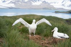
Counting animals from space has been done in a few species, mostly for surveying big species like southern right whales and polar bears from satellite images. In 2014, the US government released a game changing format of satellite imagery, called WorldView-3, that allows 30 cm resolution across the Earth’s surface. This change meant that albatross, a large, mostly white seabird, are now seen as white dots on the satellite imagery. So, instead of going to remote, isolated islands in the southern ocean where albatross breed, scientists decided to count them from satellite images. Seems a sensible choice: the birds are not disturbed, and the scientists stay warm and dry. This is also important, because 15 of 22 species of albatross are threatened by extinction, according to the International Union for the Conservation of Nature. The most pressing threats include fisheries bycatch, and marine pollution, such as plastic debris and chemicals.
In this study, the scientists counted two species of albatross: the Wandering Albatross at Bird Island, South Georgia (about 10% of global population), and Northern Royal Albatross at the Chatham Islands, 680 km east of New Zealand (about 99% of the global population). To ground truth the data, the researchers compared the estimates from satellite imagery to ground counts where nests are mapped with GPS and visited regularly during the breeding season. Based on the satellite imagery data, a mean of 330 nest sites were counted at Bird Island, about 11% more than the 297 ground truthed nests. Counts of Northern Royal Albatross based on satellite and aerial imagery were similar for one part of the Chatham Islands, and suggested a stable population: the Forty Fours island group had ~2600 breeding pairs in 2009 and 2016. However, counts at the The Sisters Island group showed a decrease from 3052 breeding pairs in 2009 to 982 breeding pairs in 2016. This could mean 2016 was a bad year for breeding, or it could be a sign that there are fewer birds in the population. Regular monitoring, using this new satellite imagery method, will help determine how much trouble this endangered species is currently in.
What did the media say?
To get media attention, there has to be a hook. With this study, it seems that the use of the new satellite imagery caught the attention of the media. Some media outlets clearly linked the use of the technology with the albatross species and how it could be used for conservation. Some did a good job at highlighting the threats to albatross species, and placing this work in a broader context. Others were more focused on the technology and associated images, and did not mention the conservation status or threats to the albatross being studied. There also did not seem to be any mention of the fact that the method may not be as precise as ground counts.
The bottom line
It is great to see the media covering the fact that new technology is being used to monitor endangered species in inaccessible places. However, providing more context and information on the threats to these endangered species, alongside information on the technology used to study them, would help raise awareness of the problems faced by albatross and other seabirds.


Trackbacks & Pingbacks